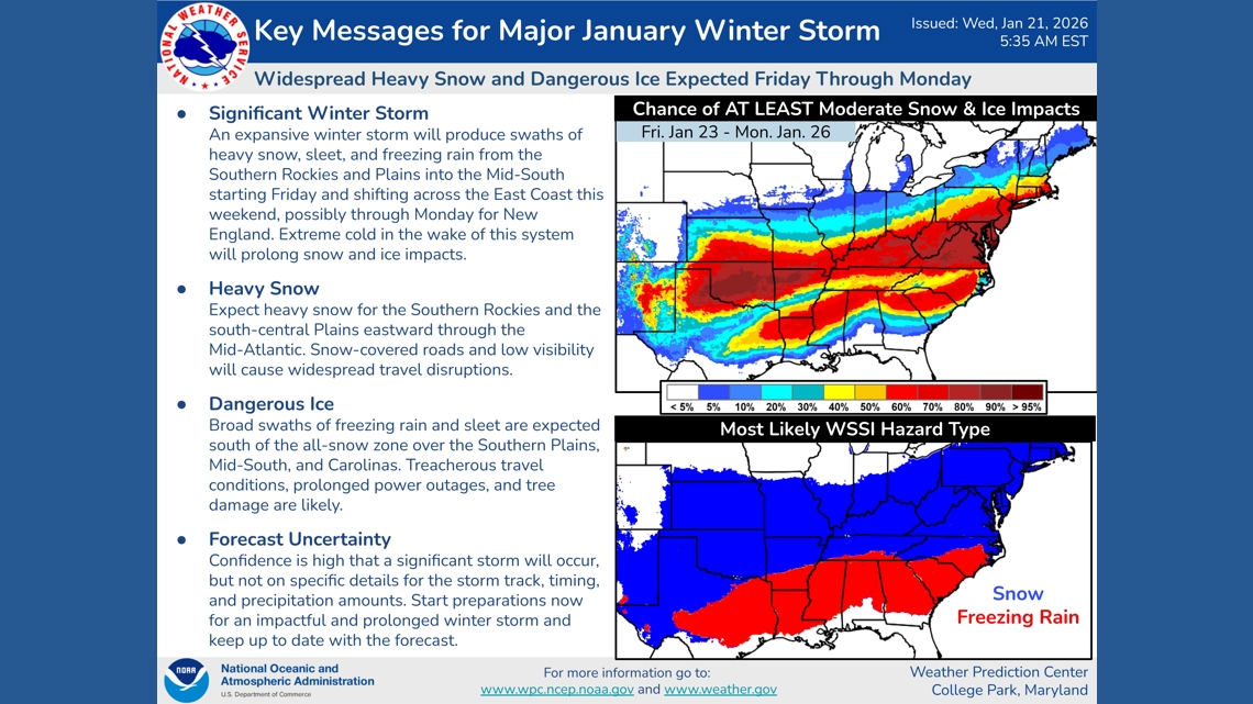
Widespread heavy snow and dangerous ice is expected in many parts of the country Friday through Monday.
ATLANTA — As millions gear up for the first major winter storm of the year, forecast models remain in generally good agreement, showing snow, ice, rain and sleet stretching from the southern Plains into the Mid-Atlantic. As of Wednesday, some of the more reliable models, including the European, had shifted slightly north, a change that could bring greater impacts to the Mid-Atlantic, the Midwest and Ohio Valley, and even the Northeast.
However, the National Weather Service’s Weather Prediction Center said in its Wednesday discussion, “This trend really has little to no impact on the fact that a widespread and significant winter storm is going to occur … but it does play a big factor in exactly where the rain, ice and snow lines set up.”

There is still plenty of time for the models to shift the storm farther south. The Weather Prediction Center noted in its discussion that models often struggle with the storm’s northern and southern components this far in advance — especially the northern piece, which remains in Canada.
The WPC wrote, “Thus we tend to think that the unanimous model trend could be a slight mirage and suggests more confidence in a solution than there actually is at this point. Either way, it should be stressed that in just about every outcome we get a widespread and major winter storm, with many areas seeing significant impacts regardless of these exact details.”
One of the greatest concerns is significant icing along Interstates 20 and 40 from Dallas to Atlanta and into the Carolinas, which could make travel impossible and trigger widespread power outages.

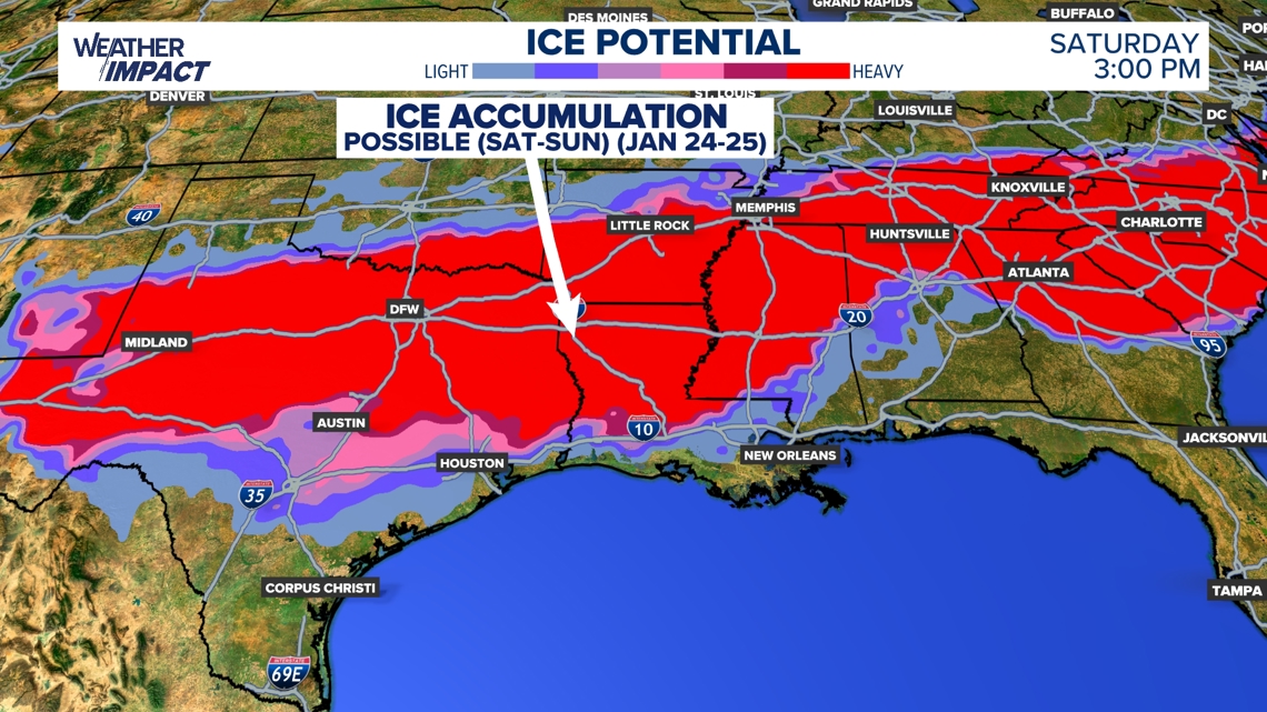
“I like to think of it as, it just so happens that the I-40 corridor is where we’re expecting more of the snow impacts, and the I-20 corridor just south of there is where we’re expecting most of the freezing rain,” said WPC warning coordination meteorologist Owen Shieh in a recorded interview.
Shieh said impacts will start early Friday in Oklahoma and West Texas and then spread east over the weekend. At this point, snow appears likely from North Texas through the Mid-South and into the Mid-Atlantic.

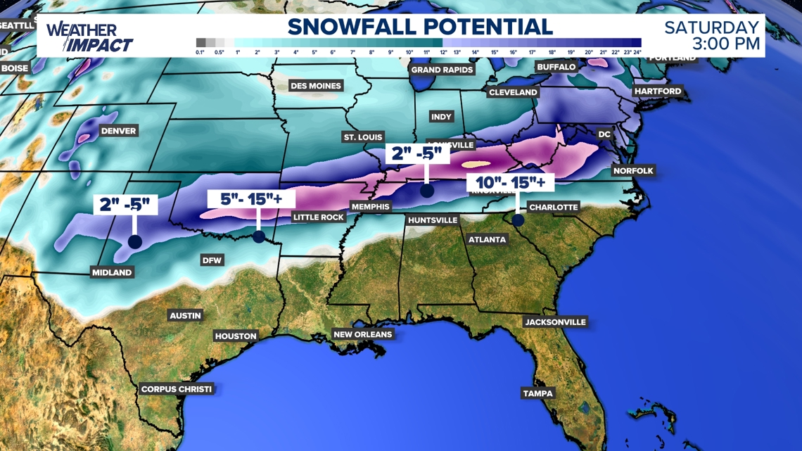
“We are seeing the computer model guidance giving us more confidence — a 70 to 80% chance — that most of the swath will get more than 4 inches of snow,” Shieh said. “There will be isolated areas where they get over a foot. It’s still too early to pinpoint where that might be, but confidence is increasing. And on the ice side, about a quarter inch of ice accumulation for a good portion of the swath looks pretty likely.”
Another factor that could make this a Southern storm for the history books is the likelihood that cold air will linger well after the precipitation ends. In Atlanta, for example, morning lows are expected to be in the 20s over the weekend and into Monday. The prolonged cold could allow slick spots to persist and pose a danger to people without power.
Right now, Shieh says it’s not the time to panic — but to prepare.
“I would encourage everyone to stay tuned to their local Weather Service forecast office,” he said. “If a watch or warning is issued, take precautions and take action according to local authorities.”